Greater Sydney Commission
Western Sydney
Land use forecast scenarios inform transformative program in Western Parkland City, Sydney.
The Greater Sydney Region Plan – A Metropolis of Three Cities sets out a future for Greater Sydney to flourish over the next 40 years as a more liveable, productive and sustainable metropolis of three cities: the Eastern Harbour City, Central River City and Western Parkland City. Of these three cities, Western Parkland City will benefit from an unprecedented change.
At the heart of Western Parkland City is the initial Place-based Infrastructure Compact (PIC) area. It includes the vast mix of urban and rural lands along the first stage of a new north-south metro line, with the emerging Airport and Aerotropolis at its centre. It will support economic hubs of new industries in the centre of Western Parkland City, generating a range of new jobs for workers across the city.
In 2019, the Greater Sydney Commission engaged SGS to develop land use forecast scenarios to support the Western Sydney PIC Program for Western Parkland City. The land use forecasts were to identify and cost the required infrastructure and services to support future growth and determine the staging and sequencing of this future growth. The process involved:
- working closely with nine local councils across Western Sydney
- consulting with other stakeholders from state and local government agencies
- reviewing planned policy, land releases and key infrastructure, and
- drawing on existing land use forecast datasets such as the Travel Zone Projections which we had prepared for Transport for NSW previously.
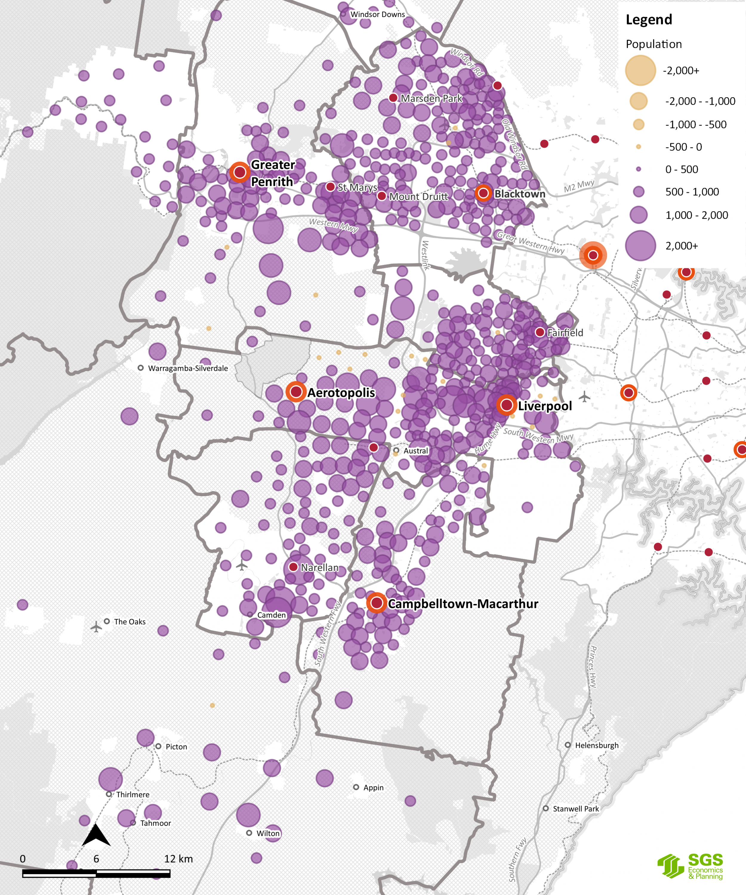
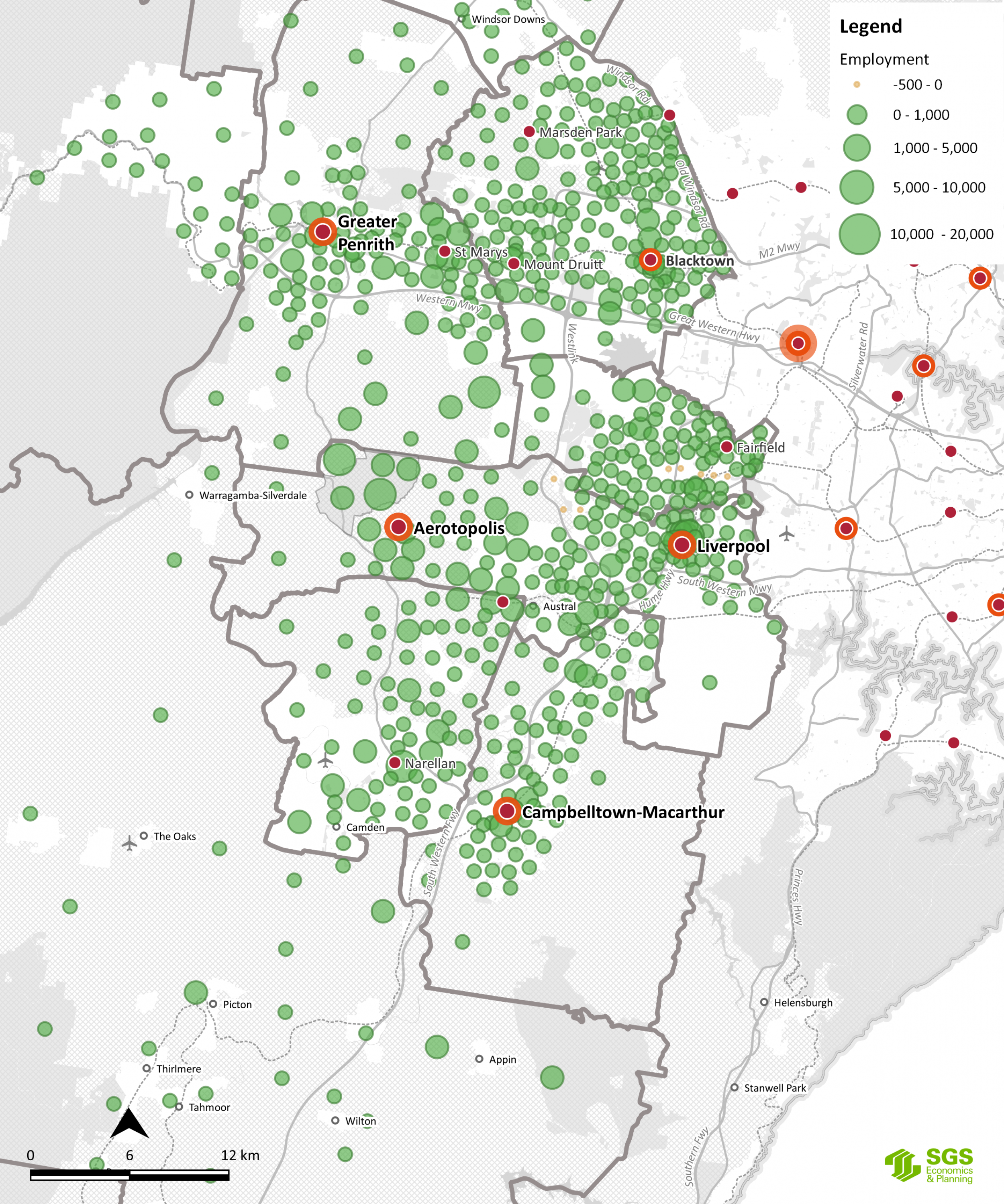
Essential to this task was understanding local government policy and data within city-wide regional planning to determine the key employment hubs and drivers for the Western Parkland City and the resident population required to support these jobs. The resulting land use forecast scenarios now inform various government agencies involved in the PIC Program and provide a common dataset for local councils.
Below are two maps showing the spatial distribution of growth in population and employment between 2036-2056 for Western Parkland City.